Better Health Through Geographic Intelligence
offered online only (asynchronous)
Since its introduction to Loma Linda University Health (LLUH) in 1996, Geographic Information Systems (GIS) have been used as a tool at different levels and in various ways to explore new health applications for advancing the education of the next generation of health professionals, refining research initiatives, enhancing critical public health practices, and advancing health care delivery; thereby improving analytical decision-making and working towards 'making man whole.'
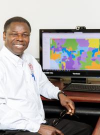
The LLUHGIS Academic program continues to expose students and faculty to Health GIS applications and educational opportunities through the post-baccalaureate health geoinformatics certificate program and Ad-hoc GIS presentations at various grand rounds and research symposiums across the LLUH campus. This program also offers professional GIS services.
Request Information BOOK GIS SERVICES
Connect with Dr. Seth Wiafe, Program Director, at [email protected].