Better Health Through Geographic Intelligence
offered online only (asynchronous)
Since its introduction to Loma Linda University Health (LLUH) in 1996, Geographic Information Systems (GIS) have been used as a tool at different levels and in various ways to explore new health applications for advancing the education of the next generation of health professionals, refining research initiatives, enhancing critical public health practices, and advancing health care delivery; thereby improving analytical decision-making and working towards 'making man whole.'
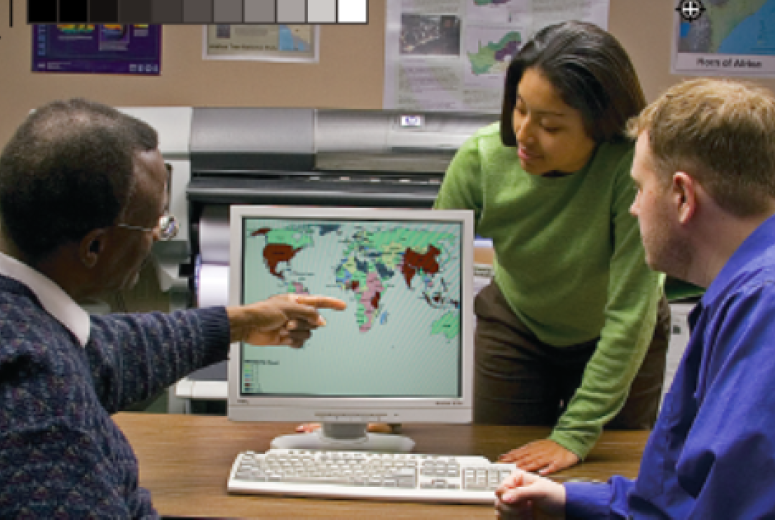
The LLUHGIS Academic program continues to expose students and faculty to Health GIS applications and educational opportunities through the post-baccalaureate health geoinformatics certificate program and Ad-hoc GIS presentations at various grand rounds and research symposiums across the LLUH campus. This program also offers professional GIS services.
Request Information BOOK GIS SERVICES
Connect with Dr. Seth Wiafe, Program Director, at [email protected].
Student Project Outcomes
Map of the Month
- November 2024: https://storymaps.arcgis.com/stories/b4785522478647d5a47936adbb196560
- January 2025: https://storymaps.arcgis.com/stories/94c2e8d306b94bcd9601818a52d9f003
- February 2025: https://storymaps.arcgis.com/stories/c7bb2b09194e4ae791761576e9357a7f
- March 2025: https://storymaps.arcgis.com/stories/20cc3092027742319133e9f903e451ca
- April 2025: https://storymaps.arcgis.com/stories/768ecb3a984543d28edc28306ad2d796
- May 2025: https://arcg.is/0uTGuj
- June 2025: https://arcg.is/11ijvf3
- July 2025: https://arcg.is/1PjGK12
- August 2025: https://arcg.is/1OHOXP0
- September 2025: https://arcg.is/0ST1LW2
Story Maps
Using Esri Story Maps, our students combine authoritative maps with narrative text, images, and multimedia content. They use the power of maps, geography, and data to tell a story. Check out some of the story maps created by our students.
- Los Angeles Animal Shelters
- http://arcg.is/0WP5ze
- By: Holly Hreha
- Environmental Justice for Coachella Valley
- https://arcg.is/0GXTu8
- By: Alissa Ianchis
- Coachella Valley: Dow, Monsanto, Gentrification, and Poverty
- https://arcg.is/0aK14S
- By: Marcus Carty
- West Nile virus
- http://arcg.is/ajnyK
- By: Gimena Ruedas
- Obesity & GIS
- https://arcg.is/0iDrLH
- Holly Hreha
- BuiltEnvironment
- https://arcg.is/1yrqiG
- By: Jesus Gutierrez
- Food RecoverIE
- https://arcg.is/L4nuv
- By: Erica Ueno
Program Details
About GIS
The LLU health geoinformatics (LLUHGIS) program continues to explore new health applications of GIS technology. Thus, LLUHGIS has become the fulcrum for spatial technology in health applications in interschool work, research, and service activities. LLUHGIS strives to maintain its status as a premier provider of health geoinformatics resources for the current and future public health workforce in the United States while continuing efforts to enhance geoinformatics capacity in countries with developing economies to advance fully interoperable information systems in many public health organizations.
Over the years, LLUHGIS has demonstrated leadership in the health geoinformatics field by achieving three important GIS educational "firsts." The school’s faculty designed and taught the first graduate-level GIS course offered at a U.S. School of Public Health in 1996. This achievement was followed by launching the country's first health geographics bachelor's degree in 1999. LLU also instituted the first post-baccalaureate graduate-level certificate in Health Geoinformatics, designed to complement existing degrees or offered as professional continuing education.
Three major operational activities that exist within LLUHGIS include Academic and workforce development, Health research, and GIS professional services. These activities are supported by the LLUHGIS Laboratory.
Program learning outcomes
By the end of the program, students will be able to:
- Apply principles of geospatial information science to health research and practice.
- Use state-of-the-art GIS software and techniques for accessing the spatially defined health information for building useful geodatabase.
- Use effective geospatial data while producing and publishing customized maps and other visual displays of health data.
- Employ GIS-based methods and techniques of spatial analysis that support health research and decision making in public health practice and policy.
- Competently apply geospatial technology and methods in at least one key area of health geographics, such as disease mapping, tracking and assessment of environmental hazards exposure, health planning and policy, population health, health education and communication, and analysis of access to health services.
- Implement and manage health GIS projects in government, nongovernment, and community settings.
GIS Research
LLUH GIS is actively involved in researching new insights and innovative solutions to health problems using geospatial technology. LLUGIS also supports faculty, staff, students, and community partners engaged in academic research projects that use geospatial technologyvb
| Project Title | Image | Description |
| Project ENRRICH: A Public Health Assessment of Residential Proximity to a Goods Movement |
| Funded by the South Coast Air Quality Management District (SCAQMD), a team of faculty, researchers, and community members from the School of Public Health collected data on the health status of several thousand people living closest to the BNSF San Bernardino rail yard. The use of geospatial tools was an integral component of this project. http://www.aqmd.gov/docs/default-source/clean-air-plans/clean-communities-plan/enrrich_final_report_29may2014.pdf |
| Turtle Awareness and Protection Studies (TAPS), Bay Islands, Honduras |
| Hawksbill and green sea turtles: International voyagers of the Atlantic and Pacific oceans. This project led by Dr. Steve Dunbar sought to increase awareness and understanding of juvenile hawksbill and green sea turtles in Honduras by tagging and mapping their locations as they moved through the water column and across the sea surface. http://www.seaturtle.org/PDF/DunbarSG_2010_InOceanglobe_p87-103.pdf |
| Taphonomy of fossil turtles and microvertebrates, and sedimentology, of the Eocene Bridger Formation, Wyoming |
| This study was led by Dr. Leonard Brand to study abundant fossil turtles, and their relationship to other vertebrate fossils and the associated sediments http://ftp.llu.edu/lbrand/bridger/bridger.htm |
| Indigent Psychiatric Need in California |
| Spatial estimation techniques were used to estimate the proportion of severe mental illness among households with incomes at less than 200% of the poverty level compared to all households http://dx.doi.org/10.1007/s11414-007-9103-1 |
| Organ Transplantation in California |
| A study to determine the geographic variation and factors related to access to kidney transplantation in California. https://proceedings.esri.com/library/userconf/health01/papers/hc01_p04a/hc01_p04a.html |
| Novel measurement of spreading pattern of influenza epidemic by using weighted standard distance method: retrospective spatial statistical study of influenza, Japan, 1999–2009 |
| GIS was used to analyze >11.1 million cases of influenza like illness (ILI) in Japan from 1999 to 2009 based on national surveillance data. http://www.ij-healthgeographics.com/content/11/1/20 |
| A Pilot Survey on the Prevalence of Clinical Challenges to Identify and Restore Unknown Dental Implants. |
| https://meridian.allenpress.com/joi/article-abstract/47/1/63/426173/A-Pilot-Survey-on-the-Prevalence-of-Clinical?redirectedFrom=fulltext |
| Recruiting population controls for case-control studies in sub-Saharan Africa: The Ghana Breast Health Study |
| A population enumeration and sampling strategy was developed to facilitate use of population controls in a breast cancer case-control study conducted in Ghana. https://journals.plos.org/plosone/article?id=10.1371/journal.pone.0215347 |
Episodic continental arc magmatic tempos of the Peruvian Arc |
| Large scale spatial-temporal study of the magmatic history of the Peruvian Andes with a GIS dashboard to view data interactively. |
Publications
LLUGIS is actively involved in research for new insights and innovative solutions to health problems using geospatial technology. LLUGIS also actively supports faculty that are engaged in funded academic research projects that use geospatial technology. Below are some current and previously funded and unfunded research activities with LLUHGIS’s involvement.
- Novel measurement of spreading pattern of influenza epidemic by using weighted standard distance method: retrospective spatial statistical study of influenza, Japan, 1999–2009
- Medicare P4P Demonstration Project in Heart Failure: Is it Pay for Performance or Pay for Punishment?
- Zip Codes or Street Addresses? Comparing Ambient Ozone Exposures for Alternative Spatial Resolutions of Cohort Subjects
- Spatial Relations Between Tobacco Pipe Use and Infant Mortality in Cambodia
- A spatial needs assessment of indigent acute psychiatric discharges in California
- Extending Disease Surveillance with GIS
- A Balloon Mapping Approach to Forecast Increases in PM10 from the Shrinking Shoreline of the Salton Sea
- Small area analysis methods in an area of limited mapping: exploratory geospatial analysis of firearm injuries in Port-au-Prince, Haiti
GIS Offerings

How to get started on your application
Admissions Requirements
The Health Geoinformatics certificate is designed primarily for health professionals and students who have completed a bachelor's degree (or equivalent) from an accredited college or university with a cumulative G.P.A. of at least 3.0. Qualified candidates must demonstrate computer proficiency, although no previous experience with geographic information systems (GIS) technology is required. In addition, Loma Linda University students, staff, and faculty who would like to learn about GIS applications in health are encouraged to apply.
Program Cost
Get details on the standard cost of attendance on the LLU website.


